
Flytrippers cofounder |
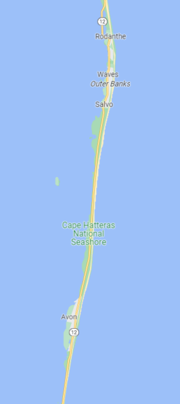
The Outer Banks (often abbreviated OBX) is a beautiful coastal region in the state of North Carolina that many have discovered thanks to a very popular Netflix series about a treasure hunt. In my case, for many years I’ve been looking forward to exploring this unique place that I haven’t been to yet despite having visited 47 of the 50 states.
The 3rd season of the Netflix series was just released yesterday, at least if you’re not among those who are well frustrated (and psychologically affected🤦) by the fact that the streaming service won’t let you share your account with unrelated people anymore.
By the way, if you’re a Netflix subscriber, instead of just earning 1% or 2% on your subscription, you should use our gift card tip with one of the credit cards that earn 5% to ≈ 7.5% in rewards at the grocery store (as you should for almost everything you buy from brands available via the grocery store gift card display)! I’ll be doing a Netflix-specific post soon to take advantage of the news, don’t miss it.
So I thought I’d tell you a little more about the Outer Banks region, which is known for its beautiful beaches, well-preserved nature, unique laid-back atmosphere and popular sporting activities (including thanks to the strong winds — which enabled one of the inventions that allows us all to travel)!
Here’s an introduction to the region and the itinerary.
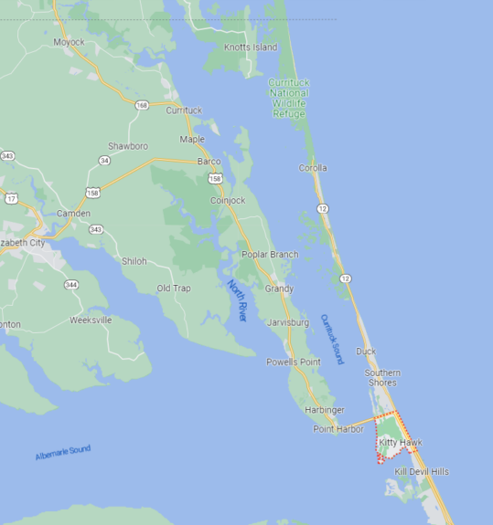
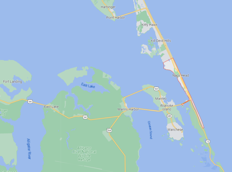
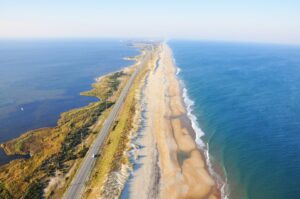
Location of the Outer Banks region
Even though the logistics will be a separate post, I want to situate you at least.
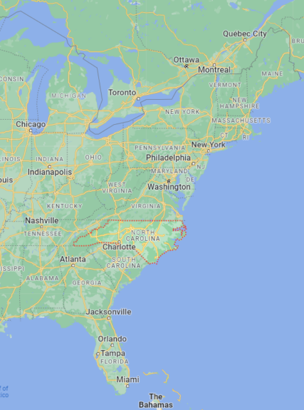
The state of North Carolina, the 9th most populous of the 50 states, is located just a little further south than the midway point of the U.S. Atlantic coast (and it’s the state with the 2nd longest coastline on the Atlantic, after Florida).
The name Outer Banks has nothing to do with the banks that give you free travel rewards: it’s the word bank as in the rising ground bordering a sea. And North Carolina has many banks; these are the outer ones.
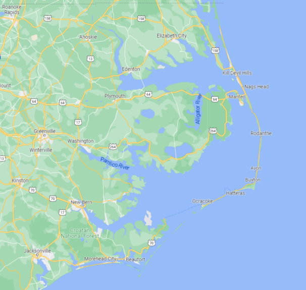
The thing is, North Carolina has a very long series of barrier islands (long narrow islands parallel to the coast): that’s what the Outer Banks region is.
So it’s really a long and narrow region!
It’s about 200 miles (320 kilometers) from one end to the other, but it’s always extremely narrow. The generally accepted definition of the Outer Banks region is from the Virginia border (in the north) to Cape Lookout (in the south).
There are 6 main islands:
- 3 islands connected by the NC 12 road
- Bodie Island (100 km)
- Hatteras Island (80 km)
- Ocracoke Island (30 km)
- 3 other small islands without roads
- North Core Banks
- South Core Banks
- Shackleford Banks
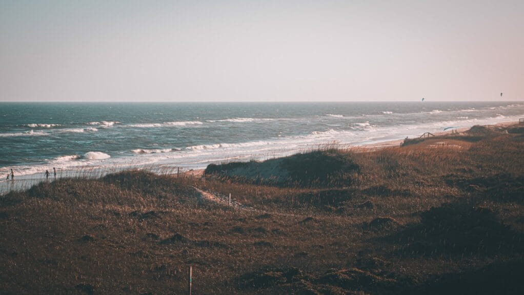
It’s a region that’s really different from the rest of the state, with its own culture and atmosphere. As you can deduct, water is the focal point of this whole area.
The ocean is on one side, and sounds (another name for lagoons) are on the other!
Although the state is more populated than most people realize, to be clear, the Outer Banks region itself is very sparsely populated.
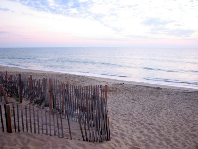
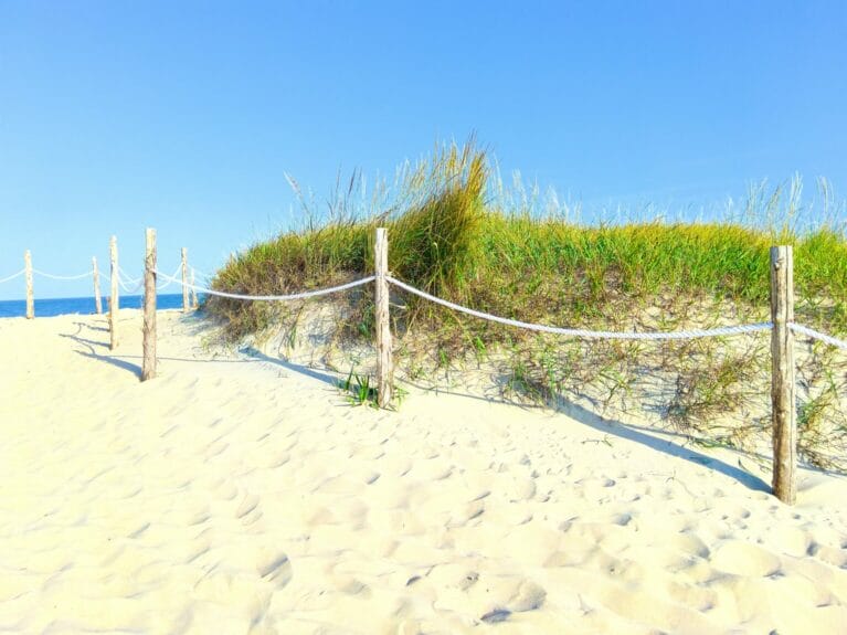
It’s what makes it so attractive: it consists of beaches and natural places that are undeveloped and beautifully preserved. There are only small towns. There are no buildings at all along the beaches in most places. It’s nature!
That makes the Outer Banks a very seasonal destination, though.
In fact, North Carolina has 3 metropolitan areas with over 1 million people… and none of them are particularly close to the Outer Banks.
The 7 places to visit in the Outer Banks
From north to south, here are the 7 places to visit in the Outer Banks region (well, the first ones for today at least).
1. Corolla and Currituck Beach
The remote northernmost tip of the Outer Banks is a nature lover’s paradise because it’s the quietest corner of the first islands — and some consider it the best-hidden secret in the entire region!
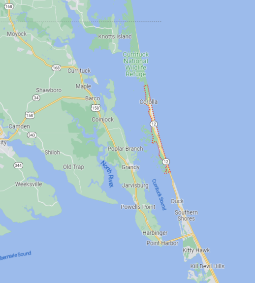
It’s quiet because this northern end of the 1st island is on the border with Virginia, but there is no road to get there from Virginia. You can only get there via Kitty Hawk (the next spot on this itinerary) and it’s a dead end that involves backtracking.
So not everyone goes there. It’s just an hour from the bridge leading to the Outer Banks, so it’s worth taking the time to go there, even if it means circling back to head south afterwards.
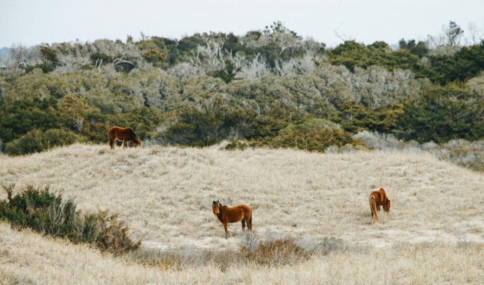
This section is known for the wild mustang horses that live on the beach, in Corolla (on Currituck Beach) for example.
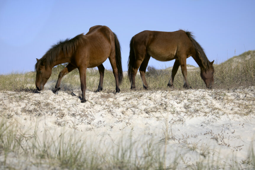
It’s also one of the many places in the Outer Banks where driving on the beach is allowed, if you want to take your Ford Mustang or Toyota Corolla alongside the mustang horses in Corolla (okay, actually maybe you need an AWD car — please double-check).
In short, the small town of Corolla is also the gateway to the Currituck Banks Reserve and Currituck National Wildlife Refuge, vast protected areas full of biodiversity.
At the very end is Carova Beach, another typical beach town that’s super remote.
This whole area looks really beautiful and quiet, it reminds me a bit of my roadtrip to do the whole Oregon coast on the Pacific, which doesn’t have big cities either.
The Outer Banks area is nicknamed the Graveyard of the Atlantic, because so many ships have run aground there.
So there are several nice lighthouses in the Outer Banks, like Currituck Beach Lighthouse, which is one of the few that is not black and white (but if you want to visit just 1, you might as well check out the tallest one in North America later on this itinerary).
You can climb the 220 steps, as is often the case with lighthouses.
It will give you a nice 360-degree view!
Right next door is Historic Corolla Park, which offers free admission to its lovely sound front site. It has a few attractions, including hiking trails, kayak launches, and fishing.
You can find the Currituck Maritime Museum, the Outer Banks Center for Wildlife Education, and the Historic Whalehead Club, a large house you can visit.
If you like to climb and throw axes, there’s also Corolla Adventure Park.
On the way back, you can stop at Southern Shores Beach.
Or walk on the very original boardwalk on the sound side in the small village of Duck.
The Hampton Inn & Suites Outer Banks Corolla is a Hilton hotel, which is actually one of the few hotels in this area, if you want to stay more than a day in the north end (and prefer chain hotels or earning Hilton points). Otherwise, The Inn at Corolla Lighthouse seems like the only option for more authentic hotels.
2. Kill Devil Hills and Kitty Hawk
If you’re coming from the north, the neighboring towns of Kill Devil Hills and Kitty Hawk (pretty unique names) are the gateway to the Outer Banks region on Bodie Island. It’s just an hour and a half from Virginia Beach, a popular roadtrip destination for many Canadians.
If you want to change the order by visiting Corolla and the northernmost section after visiting Kill Devil Hills and Kitty Hawk, you can obviously do that, and it won’t be a much longer detour.
(After that, the rest of the Outer Banks is just a straight line, so it’s pretty much the only thing you can change in terms of the order in the itinerary because of the particular geography of this area — besides obviously going from south to north instead!)
The town of Kill Devil Hills has just 7,000 inhabitants… and it’s the most populated in the entire Outer Banks region! That being said, the entire region sees its population increase significantly in the summer, obviously.
Many like to use one of these cities as their base to explore the OBX.
I’ll get to the hotels at the end of the section again, but Airbnb and Vrbo accommodation rentals are really popular in the Outer Banks — as is camping!
Kitty Hawk and Kill Devil Hills have great beaches like everywhere else in the Outer Banks.
They are not in an all-natural environment with no development around them like others, but they are still beautiful, no doubt.
The only downside is that sometimes it’s really windy on the beaches here.
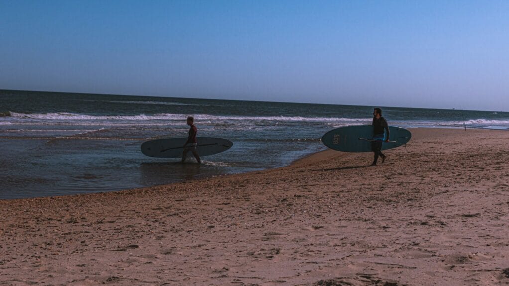
As in most of the region, on the beaches, surfing and kitesurfing are therefore almost as popular as relaxing.
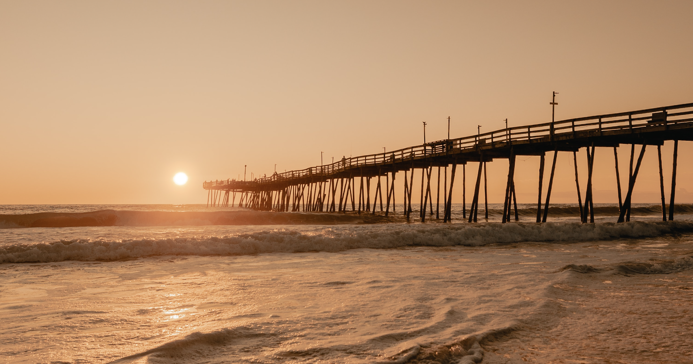
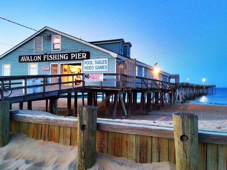
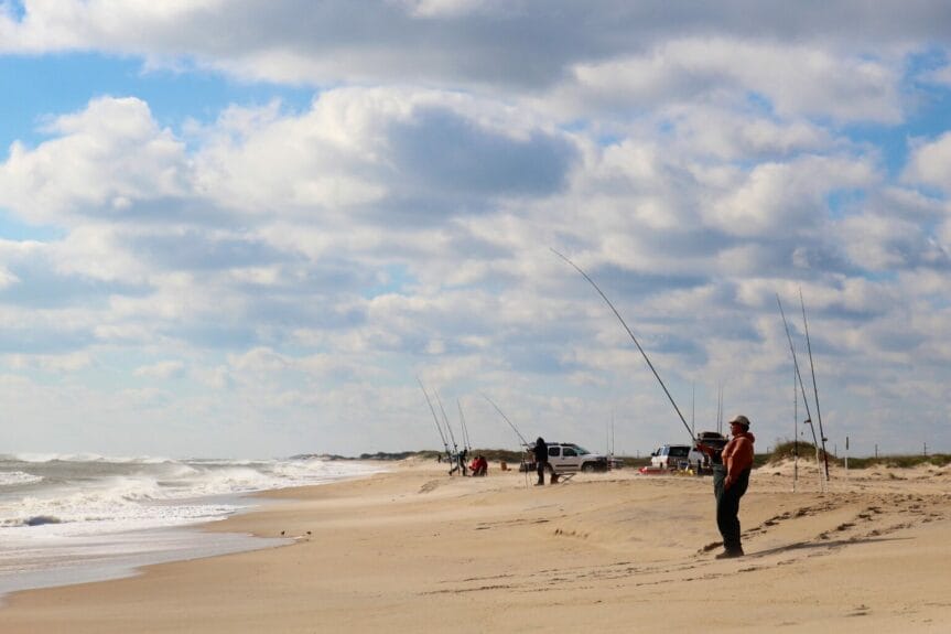
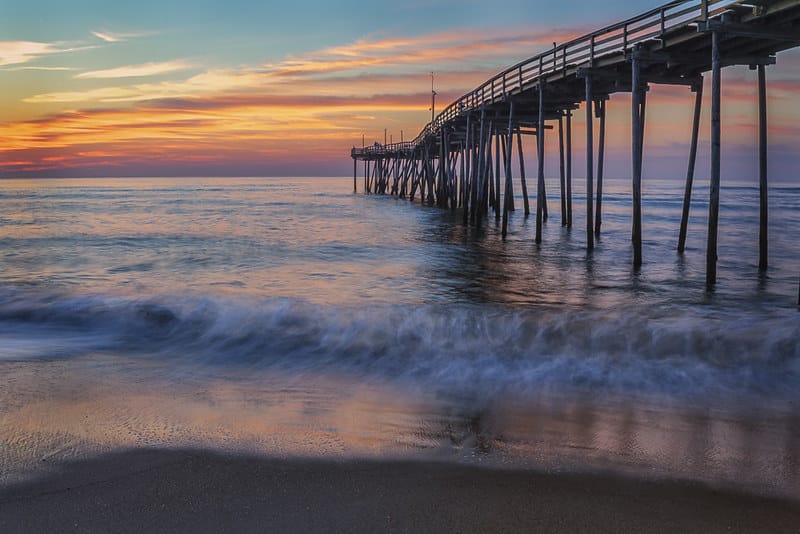
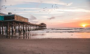
Almost every town in the Outer Banks has a fishing pier, and in Kill Devil Hills, there is the Avalon Fishing Pier where you can spend some time.
Nags Head Woods Preserve protects one of the largest maritime forests in the eastern U.S. and has hiking trails as well. It straddles Kill Devil Hills and the next place in the south.
You can also go hiking at Kitty Hawk Woods Coastal Reserve or Sandy Run Park, which has wooden boardwalks over the wetlands and is full of turtles and other wildlife, including birdwatching opportunities.
If you like vintage Americana, you can go to Sam’s Diner, a small restaurant dating back to the 1940s that is also classified as historic. You don’t have to take Route 66 for this type of atmosphere!
As an aviation enthusiast, I must mention that it’s in the Outer Banks area that the first flight in history took place!
You may have previously noticed this from the First in Flight mention on North Carolina license plates or the state’s commemorative coin, if you go to the States sometimes.
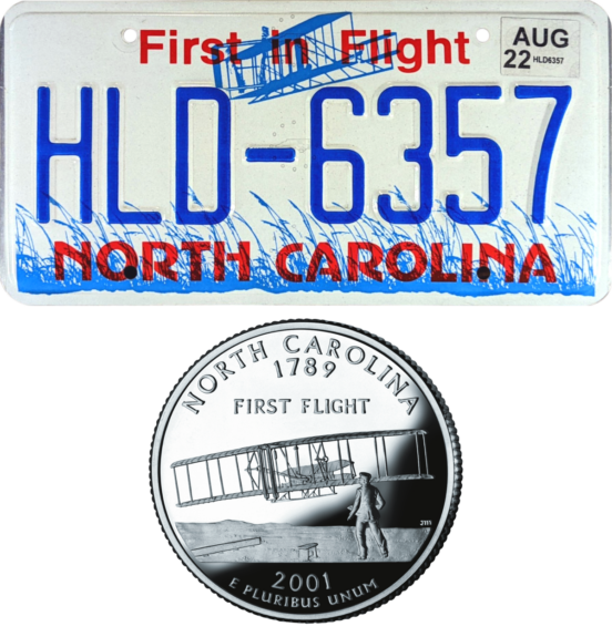
In short, it’s pretty major. It’s what makes it so easy for all of us to travel and explore the world!
The Wright brothers flew their airplane in the Outer Banks in 1903, just 2 months after the New York Times actually published that it would take “1 to 10 million years” before humans could create a flying machine.
(3 lessons: as with the pandemic, don’t blindly trust the “experts” of course; never let someone convince you that something is not possible; predicting the future is very difficult!)

It was in Kill Devil Hills, but the city didn’t exist yet, so sometimes people say the first flight took place in Kitty Hawk (which was the closest city that existed 120 years ago).
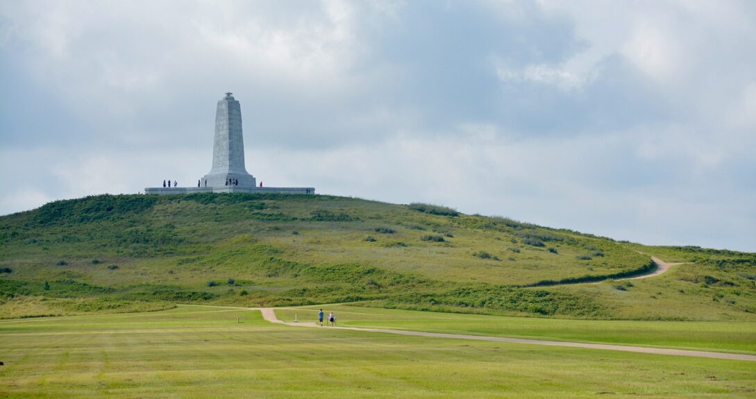
You can check out the Wright Brothers National Memorial, to have at least one thing that isn’t beach, nature, or outdoor related on your trip.
It’s also the highest-rated attraction on the Outer Banks. There’s a visitor’s center where you can learn about all of this, along with a full-size replica of the plane, the world’s first-ever airplane hangar, etc.
Also, just as you enter the Outer Banks in Kitty Hawk, the Monument to a Century of Flight commemorates it all as well, but that one is just a series of sculptures.
The Wright brothers were not from Carolina, but they specifically chose this location to test the first flight because it was known to have good winds to lift an airplane and soft sandy surfaces (and they enjoyed the privacy of the quiet location).
Finally, this is where you’ll find the only Marriott hotel in the entire Outer Banks region, the TownePlace Suites Outer Banks Kill Devil Hills, if you want to earn Marriott points (or maybe use them, but since it’s an expensive country, it’s not often a good redemption to maximize your free nights).
This is also where there are the most chain hotels:
- Hilton Garden Inn Outer Banks/Kitty Hawk (Hilton)
- Comfort Inn On The Ocean (Choice)
- Quality Inn Carolina Oceanfront (Choice)
- Days Inn by Wyndham Kill Devil Hills Oceanfront Wilbur (Wyndham)
- Days Inn & Suites by Wyndham Kill Devil Hills-Mariner (Wyndham)
- Travelodge by Wyndham Outer Banks/Kill Devil Hills (Wyndham)
In terms of more local hotels, the Outer Banks Inn seems like the best value.
3. Nags Head and Roanoke Island
Nags Head is really just past Kill Devil Hills, but it is one of the most popular spots on Bodie Island and deserves its own section.
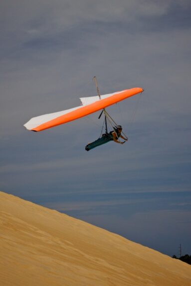
It’s another place with both beaches and parks, in this case the main attraction is Jockey’s Ridge State Park.
You’ll find the tallest active sand dune system in the eastern United States. What’s unique is that the landscape and landforms here change every summer.
So it’s the most visited state park in North Carolina, and it’s free too! The temperature of the sand can reach 60 degrees (that’s well in celsius, unfortunately), so it can get hot in the summer!
The park also has the largest hang gliding school in the world, kitesurfing, and many other activities, such as zip lines.
Speaking of adventure, you can also get in the water to dive and explore the wreck of the USS Huron, a very old American military ship that ran aground at Nags Head.
The beach in Nags Head is also a great place to stop after all these activities.
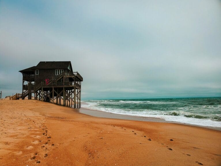
The typical wooden beach house style is very pretty; you can admire it at the Nags Head Beach Cottages Historic District if you like architecture.
Jennette’s Pier also provides one of the most beautiful views of the beach and the colorful houses.
It’s not just aviation history: British settlement of the United States also began in the Outer Banks.
The Roanoke Colony was the very first permanent settlement, on Roanoake Island. It’s a smaller island in the sound on the mainland side, along the main island (the bridge is almost in a straight line from Jennette’s Pier in Nags Head).
It’s where the first child born in America to British parents was born, in 1587. A supply ship caused the colony’s disappearance. More specifically, all the inhabitants disappeared and were never seen again (your delayed flight isn’t that bad now, is it?). Historians assume that they all assimilated into the indigenous peoples in the area.
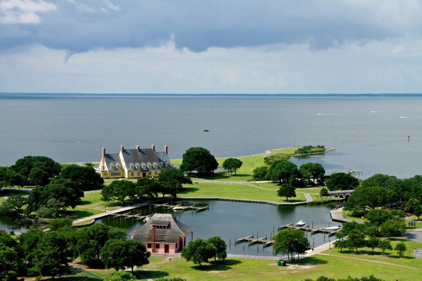
The Fort Raleigh National Historic Site preserves the history of the first colony and is worth a visit for those who love to learn. Those who love botanical gardens can find the Elizabethan Gardens created to honor the lost colonists.

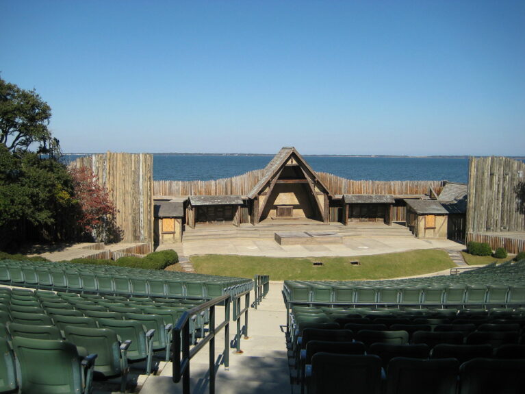
For those who love theater, there’s The Lost Colony, a play that has been presented there every summer for over 80 years.
It’s in a beautiful amphitheater overlooking the sound.
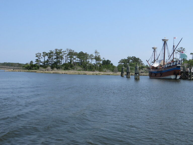
Elsewhere on Roanoke Island, you can visit Island Farm, which is also inspired by the first settlement.
So is a 16th-century replica ship at Roanoke Island Festival Park.
Roanoke Island also has Outer Banks Distilling, the area’s first distillery, in the town of Manteo. They offer tastings of their small-batch rums.
Right next door is a funny lighthouse that looks more like a regular house, the Roanoke Marshes Light, and the Roanoke Island Maritime Museum.
The North Carolina Aquarium can be an indoor activity option. And if you cross another bridge to the mainland, the Alligator River National Wildlife Refuge is nearby as well.
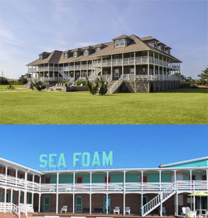
For lodging, in Nags Head you can combine the practical element and the historical one.
You can stay in 2 establishments that have been classified as historic. The First Colony Inn opened in 1932 and is now a luxury hotel, while the Sea Foam Motel dates back to the 1940s (with a neon sign to match) and is a more affordable option.
Otherwise, in terms of chain hotels, you have:
- Holiday Inn Express Nags Head Oceanfront (IHG)
- Comfort Inn South Oceanfront (Choice)
- Ramada Plaza by Wyndham Nags Head Oceanfront (Wyndham)
Hotels that are more local on Roanoke Island can be more affordable since they’re further from the ocean, like the Scarborough Inn.
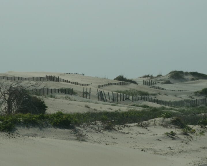
4. Northern end of Cape Hatteras National Seashore
It is at the end of the 1st long island, Bodie Island (which is not even an island anymore in fact), that the Outer Banks’ most famous attraction, the Cape Hatteras National Seashore, begins. I also include the northern end of the 2nd island (or 1st real island), Hatteras Island, as a combined stop for this itinerary.
Why? Well the south end of Bodie Island and the north end of Hatteras Island are both places where there is no development, just nature. It feels different, after the (relatively) developed beginning of the itinerary.
Again, the Outer Banks are the site of a first (in addition to being the site of the 1st airplane flight and the 1st British settlement in America)!
The USA’s National Seashores, essentially national parks that protect the coastline, started right here with the Cape Hatteras National Seashore (and now there are a total of 10).
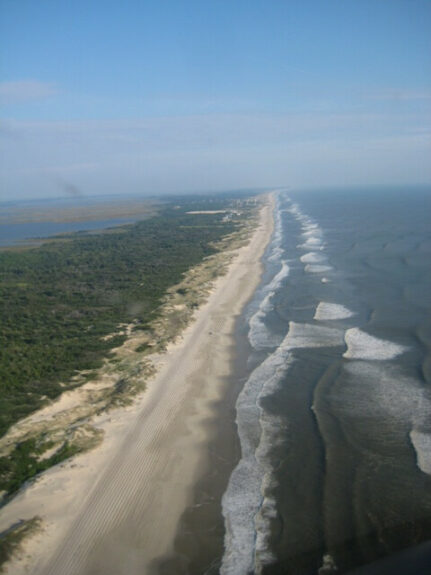
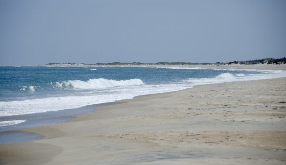
This results in beautiful beaches often rated among the best in the country (like the #1 beach in the USA in 2022; more on that later)!
Some consider this stretch one of the most beautiful roadtrips in the country as well.
The first beach is Coquina Beach, near the southern end of Bodie Island, just after the developed area ends.
(By the way, this end was also a separate island before, but as is very common in this fragile, erosion-prone natural habitat, the shape of the coastline evolved, and the island has merged with the main one that goes all the way to Virginia… which is actually now connected with the mainland, even though it sure looks like an island!)
Then there’s Bodie Island Lighthouse, which was just renovated in 2013 and can be visited if you climb the 214 steps.
(No, we haven’t made it to the tallest lighthouse in North America yet; that’s another one that’s almost at the other end of Cape Hatteras National Seashore!)
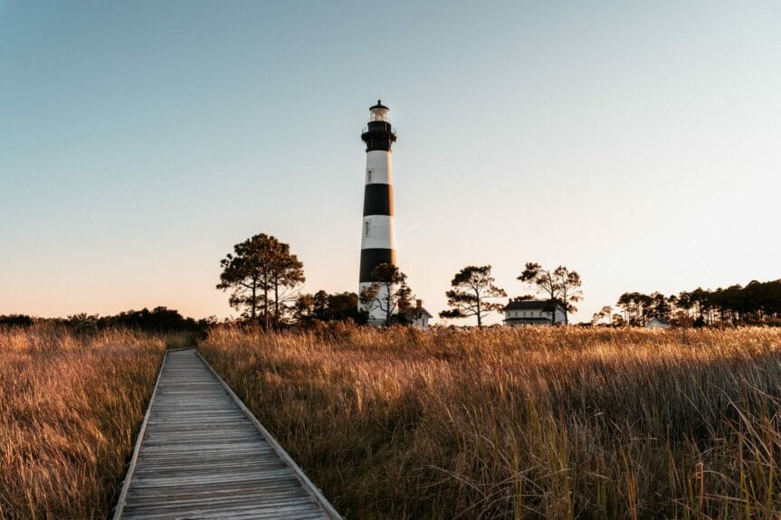
Near the lighthouse is also where the first of the visitor centers for the Cape Hatteras National Seashore is located.
There are also some great swamp hikes in this area.
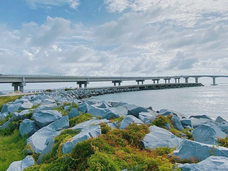
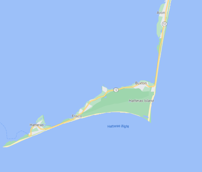
About 100 kilometers from the Virginia border, the 2nd island (or 1st real island) in the Outer Banks finally begins, Hatteras Island. It’s one of the longest islands in the United States by the way!
The lovely Basnight Bridge takes you there.
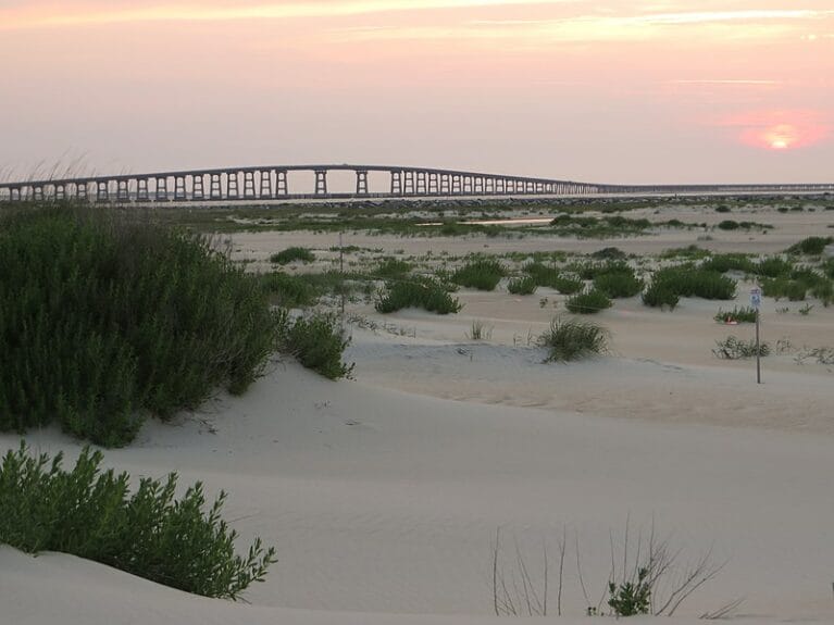
Right next door is the Bonner Bridge Pier if you want to get a nice view of the bridge (or the inlet between the 2 islands). Or if you want to fish.
Technically, there was also a separate island there, Pea Island. But it recently remerged with Hatteras Island.
The Pea Island National Wildlife Refuge is a large protected area for birds that takes up most of the space at the north end of Hatteras Island. You can find 365 different species of birds here!
The old Oregon Inlet Lifeguard Station near the bridge is just about the only building in this entire section of the OBX.
It’s an area that is undeveloped and wild.
You can hike the North Pond Trail… or just enjoy a place where the beach is quiet and peaceful!
So in terms of accommodations, there’s really nothing available between the towns of Nags Head and Rodanthe; it’s just nature.
5. Rodanthe, Waves, Salvo, and Avon
The next part of Hatteras Island includes 4 small towns popular with those who love the OBX and the main segment of the Cape Hatteras National Seashore that continues south. Here, the Outer Banks start being really far from the mainland too!
The first village on Hatteras Island is Rodanthe.
The story of a book (later adapted into a movie) by popular author Nicholas Sparks, Nights in Rodanthe, is set there and has made the name of the town a little more well-known than the average village with a population of 213.
It’s repetitive, yes, but we’re talking about the Outer Banks after all: the beaches are beautiful.
Like the rest of the OBX, there are plenty of water activities available like kiteboarding. And you can do these even if you don’t have your own equipment, with Kitty Hawk Kites or REAL Watersports, for example.
Rodanthe has its own pier, as does almost every place (it’s the easternmost point in all of North Carolina).
The fishing is apparently particularly good from there thanks to the currents that cross here (these same currents are what make the surfing excellent here).
If you like history and museums, the Chicamacomico Life-Saving Station Historic Site & Museum is the most comprehensive in the entire USA on the topic of the old lifeguard service.
By the way, the boundaries of the first 3 cities are quite abstract. The 3 are close together and often considered to be one village, known as Chicamacomico.
But officially, continuing along the Cape Hatteras National Seashore, there is then the small town of Waves.
With a name like Waves, you know that the waves are very good there (yes, the name of the city really comes from that)!
If you’re interested, what makes surfing so excellent in the OBX is the convergence of 2 strong currents: the Labrador Current and the Gulf Stream.
Just after Waves, there is Salvo.
Like the other 2, it’s very small, but it’s very pretty.
It’s another beautiful place to just relax, especially at Salvo Beach.
In addition to the beaches, the Salvo Day Use Area is another park on the sound side that is popular for kiteboarding but also for stargazing!
You can rent dune buggies at Island Cruisers if you want to have some fun.
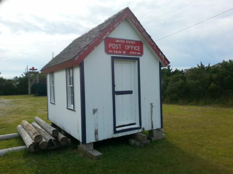
Otherwise, the village was famous for its post office, one of the smallest in the country (it was closed in 1992).
If you’re lucky (depending on how the sand has moved), you can also see a shipwreck on the beach, the G.A. Kohler that’s been there since 1933, near ramp #27 (there are a few others all along the Outer Banks).
After Salvo, there’s one of those long stretches with beaches entirely in their natural state, with no development around.
You can go to the beach anywhere, and some of them have names: Bald Beach, Kinnakeet Beach, or Black Pelican Beach.
Then there’s the village of Avon, which has a few more amenities than the first 3 spots. More choices in terms of restaurants and stores like Island Spice & Wine for groceries or Sandcastles for souvenirs.
And Avon obviously has its own beautiful beach.
The Avon Fishing Pier provides a particularly lovely view of the ocean; it’s about as Outer Banks as you can get!
You can rent all the equipment you want to do any activity at Ocean Atlantic Rentals.
Or hit the spa or beach club at Koru Village. Or just chill on the beach.
Finally, just past Avon, there’s a place with a great name, Canadian Hole. It’s one of the best places in the world for windsurfing and is one of the most beloved spots on the Outer Banks.
It’s really called that way because so many Canadian windsurfers go there! The other name of the site is Haulover and it’s well indicated on the road, but with the number of sails there, it’s apparently very hard to miss!
There is also ample parking so it’s one of the most accessible locations for both the sound side and the ocean side, on both sides of the NC 12 road.
In terms of accommodations, it’s primarily campgrounds and private rentals like Airbnb and Vrbo; there are no hotels at all on this long stretch of the Outer Banks.
6. Cape Hatteras
Still on Hatteras Island, there is the cape that the Cape Hatteras National Seashore is named for. The barrier island changes direction abruptly here. This is probably the most popular stop on this entire itinerary!
Around Cape Hatteras, it’s the widest point of the entire Outer Banks region (it’s still very narrow). It’s also the closest point to Bermuda.
Here, there are 3 small towns named Buxton, Frisco, and Hatteras.
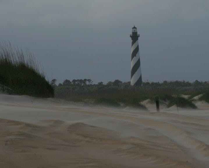
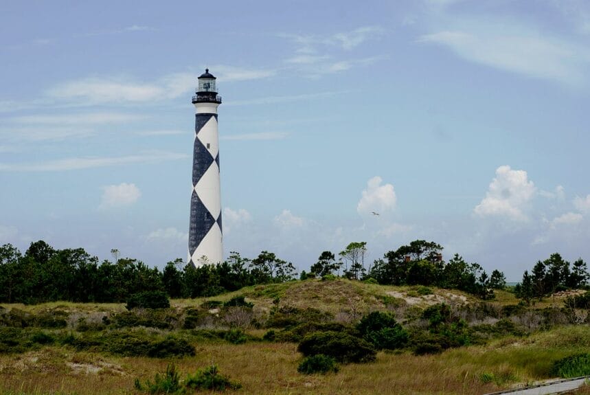
In Buxton, the most populated of Hatteras Island (it’s still tiny of course), there’s the Cape Hatteras Lighthouse, the tallest lighthouse in all of North America and the 2nd tallest brick lighthouse in the world.
It’s one of the most famous, with its rather unique black and white striped design. It’s probably the most popular symbol for the entire Outer Banks region.
It offers a pretty impressive view after you climb the 257 steps.
Fun fact: the lighthouse was moved in 1999 because the infamous coastal erosion made it become too close to the water. As you can imagine, it’s a pretty complex operation to move something that high.
It was moved really far away, as you can see here, with the town of Buxton right behind (and in the distance, there is Avon, from the previous stop on the itinerary).
Next to the lighthouse, there’s also the Hatteras Island Visitor Center and the Museum of the Sea.
Right next door is Old Lighthouse Beach, named the 2nd best beach on the Outer Banks!
(I’ll get to beach #1 at the next stop!)
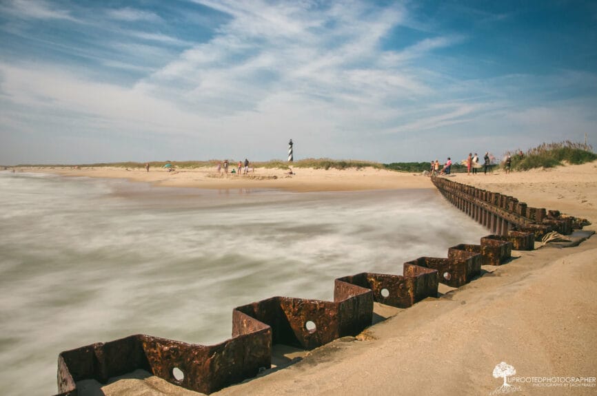
The seawall was built to try to slow down the erosion and to avoid having to move the lighthouse, without success.
There is Cape Point Beach which is on the tip of the cape, as you inferred from the name.
The beach and the park there is another popular spot.
If you get tired of the roads, there are plenty of trails to explore with all-terrain vehicles!
It’s really a place that has something for all types of travelers.
Buxton’s beaches are popular for surfing. There are classes offered, like Sunnie’s Surf Lessons.
It’s actually one of the best places to surf on the entire East Coast.
The SS Lancing wreck is another opportunity for wreck diving. A Nazi U-boat sank the ship during World War II.
A good part of this portion of the island is preserved too, it’s the Buxton Woods Coastal Reserve, where you can find the Buxton Woods Nature Trail for a walk in something other than sand.
You can look for shells if that’s ever an activity you like. The Outer Banks area is known as a great place to find beautiful ones.
If you want fresh local seafood, Buxton Seafood is the top-rated place. Uncle Eddy’s Frozen Custard and 18-Hole Mini Golf is the spot for dessert — or to play mini golf.
Continuing always on the same NC 12 road from the beginning, you arrive in Frisco.
Frisco Beach is another very nice one.
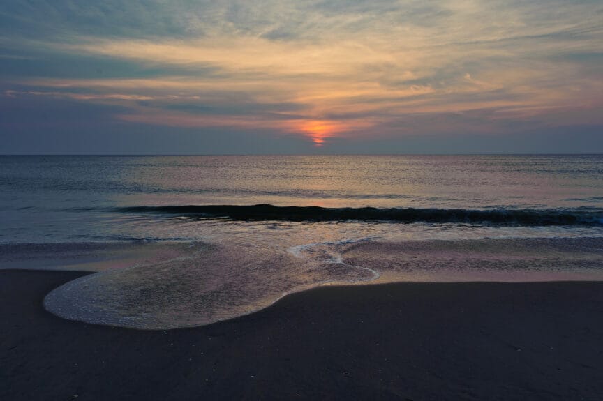
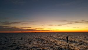
I’m very partial to the ocean side over the sound side for obvious reasons, but one thing only the sound can have in the Outer Banks is a sunset over the water.
The mainland is so far away at this point of the OBX that the sound looks like an ocean too though!
If you want to go horseback riding on the beach, Equine Adventures offers this activity in Frisco (otherwise, there’s Hatteras Island Horseback Riding further down the island).
The best fudge in the area is apparently at Scotch Bonnet Fudge & Gifts. And to switch things up, the Frisco Native American Museum allows you to learn about the history of the native peoples of the area.
Kiteboarding is popular in many places along the coast, but especially in this part of Hatteras Island.
Another activity is kayaking in Pamlico Sound, between Hatteras Island and the mainland.
Finally, almost at the end of the 2nd long island of the Outer Banks, there’s the town of Hatteras (sometimes called Hatteras Village to distinguish it from the entire island).
You can find the Graveyard of the Atlantic Museum here if that part of the region’s history interests you and if you’re in the mood for a rare indoor activity in the OBX.
The Hatteras Island Ocean Center also has indoor exhibits and outdoor activities. Slash Creek Outfitters offers equipment rentals like many others do in the OBX.
Harbor House Seafood is a popular gourmet stop. There is the Blue Pelican Gallery and Lee Robinson’s General Store for those who like small souvenir stores.
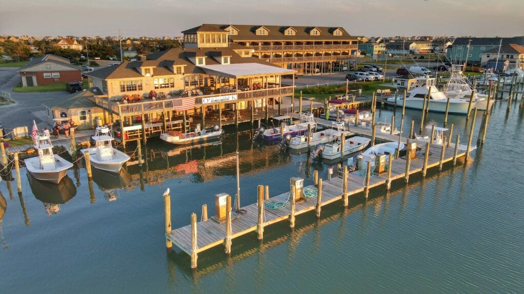
The town of Hatteras is considered the blue marlin capital, so fishing is a popular activity. The Pamlico Sound is one of the largest marine estuaries in the world and is an excellent place for that!
If you like to go boating, whether to fish or just to enjoy the water, it’s a place where there are boats available.
After the village of Hatteras, you can make a slight detour to a dead end at the very tip of the island.
It’s a protected area.
In terms of accommodations, there are no chain hotels here, like on the rest of Hatteras Island. The Swell Motel in Buxton and the Sea Gull by Kees Vacation in Hatteras seem to be the best options in terms of price if camping isn’t your thing.
7. Ocracoke Island
More than 170 kilometers from the beginning of the region, the road stops at Hatteras Village. Or rather the road is interrupted at Hatteras Village. You have to take a ferry — completely free of charge — to get to the next island, Ocracoke Island.
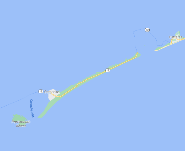
The trip on the North Carolina Ferry takes just under an hour, which is probably about twice as long as it would take if the boat was going in a straight line.
You may have noticed the really indirect route on the map — the ferry takes quite a detour around the Hatteras Inlet Crab Spawning Sanctuary!
The boat ride itself is a fantastic experience, especially at sunrise or sunset.
Ocracoke Island is less than half the length of the previous 2 islands; it is less than 30 kilometers long. It is called the Pearl of the Outer Banks.
Because of its smaller size, geographic location, and accessibility by boat only, many find Ocracoke Island much quieter than the rest of the Outer Banks. This gives it something very unique.
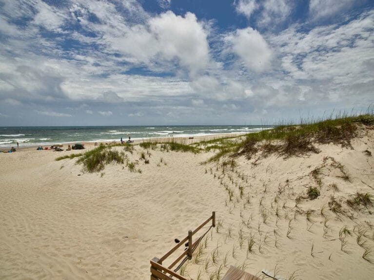
Ocracoke has secluded beaches for all tastes, including one named the most beautiful in the United States.
The island is very sparsely populated and has just one small village, which is very beautiful, by the way. So almost the entire island is just beaches and protected areas.
Like many places in the OBX, you can drive on the beach (with a permit).
But before you get to the most beautiful beach (it’s at the end of the island), there are beaches all along the island!
You can visit Pony Pastures Beach (also called Pony Pen Beach).
Like all the beaches in Ocacoke, there’s nothing around! Pure bliss.
Pony Pen Beach’s name comes from the Ocracoke Pony Pens next door, a place where there is a herd of wild ponies that you can go see.
One of the places you can go for a hike is the Hammock Hills Nature Trail.
Also, like in many of the Outer Banks’ protected areas, there are turtle nesting areas!
Just before you get to the village of Ocracoke at the end of the island, there is Ocracoke Lifeguard Beach (also known as just Ocracoke Beach).
This is the one that was voted the #1 beach in the entire country as recently as 2022, by the Dr. Beach ranking.
Not in Hawaii, not in Florida, not in California! On Ocracoke Island.
The village of Ocracoke is where you can access Springer’s Point Preserve.
It’s even the highest-rated attraction on the island.
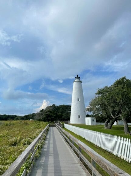
It wouldn’t be an Outer Banks island without a lighthouse, of course! Let me remind you that the area is nicknamed the Graveyard of the Atlantic!
The Ocracoke Island Lighthouse is less imposing than the other 3 on this itinerary… but all lighthouses have a certain charm. This one is the oldest still in operation in North Carolina.
Okracoke is a very nice little village on the edge of a harbor, on the sound side.
The 1718 Brewing Ocracoke brewery and all the restaurants on the island are located there!
You can find the Over the Moon Art Gallery, the Down Creek Art Gallery and quirky little stores like the Village Craftsmen, Island RagPicker, and Pirates Chest. There’s also the Deepwater Theater for summer theater and the Coyote Music Den for concerts.
And if you want to learn, there’s the Ocracoke Island Visitor Center, the Ocracoke Preservation Society Museum, and the Fort Ocracoke Monument.
There are a few vendors for water activities as well, such as Ride The Wind Surf & Kayak store, Ocracoke Adventures tours, Restless Native boat rentals, Coast & Go bike rentals, and Ocracoke Island Golf Carts (they’re popular to move around the island).
Without spoiling anything from season 3 of the Outer Banks show, it was revealed that season 4 would revolve around the story of Blackbeard, the famous pirate. By the way, the town where the show is set, Kildare, is entirely fictional!
But Ocracoke is where Blackbeard took refuge at the end of his reign — and where he was killed. Blackbeard’s Lodge is an accommodation option that pays homage to this story.
While we’re on the subject, in terms of accommodations, it’s pretty limited as well outside of Airbnb and Vrbo again. There are no chain hotels, and the Ocracoke Harbor Inn seems to have both the best rating and the best price (which is still awfully high, obviously), a pretty rare combination.
And there’s camping, of course.
Much like the end of Hatteras Island, you can actually continue past the village of Ocracoke to a quiet, secluded spot at the tip of the island.
It’s called Sunrise Point at the end of South Point Drive, at beach access ramp #72.
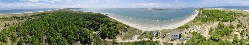
At the end of Ocracoke Island, it’s the end of the Cape Hatteras National Seashore… but there’s another protected coastline that begins. And there are other islands officially considered part of the Outer Banks, but which are really special.
Bonus: Cape Lookout National Seashore
After the main islands of Bodie, Hatteras, and Ocracoke… the Outer Banks region is not over! There are still 3 main islands (and 1 smaller island), but they are entirely protected and wild! There are no inhabitants, not even a road! It’s the Cape Lookout National Seashore.
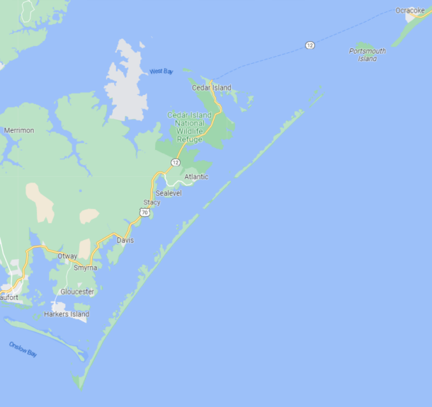
Yes, there are just 10 National Seashores in the entire country… and North Carolina has a 2nd one that is right next to the other.
The Cape Lookout National Seashore is also sometimes called the Crystal Coast.
It’s 90 kilometers of protected coastline and nature. The islands of North Core Banks, South Core Banks, and Shackleford Banks are truly a place for those who love nature in its purest state.
Not only are these islands accessible by boat only, you even have to go back to the mainland first because you can’t get there directly from Ocracoke Island (i.e. you have to take 2 boats to get there if you’re coming from the rest of the Outer Banks).
To get to Cape Lookout National Seashore, the first ferry from Ocracoke Island takes you to Cedar Island (on the mainland). It takes more than 2 hours and costs 15$US per vehicle.
Then, after a 20-minute drive, you can take another small ferry to one of the 3 islands of the Cape Lookout National Seashore.
There are actually a few different ferry options, considering the vastness of these 3 islands. It all depends on where exactly you want to go. This official National Park Service map can help you find your way.
In fact, there is a 4th island that is small and is right next to Ocracoke Island, Portsmouth Island. That one can be visited by boat from Ocracoke directly, for example with Portsmouth Island Boat Tour. Portsmouth is a small island where a town was founded in 1753, but it is no longer inhabited since it was abandoned in 1971. You can see the Portsmouth Village Historic District with its 21 preserved buildings and a nice secluded beach, but it’s pretty much all there is on the island.
Depending on the tide, you can sometimes continue to the 1st of the 3 main islands of the Cape Lookout National Seashore from Portsmouth Island, because the islands sometimes become connected (it doesn’t seem like that at all on Google Maps). But it’s not guaranteed and not very convenient either. You won’t have your car and will be far from the central part of the main island.
Nature is really the main attraction of these islands. There are all kinds of flora and fauna, including wild horses here too.
The Cape Lookout Lighthouse is another lovely lighthouse with a unique diamond pattern design. The different patterns of each lighthouse in the area are obviously made on purpose to distinguish the lighthouses from one another easily.
The pattern of this one has another purpose: the center of the white diamonds points precisely to the East/West, while the center of the black diamonds points precisely to the North/South. Useful when the lighthouse is on the tip of a cape that is quite abrupt.
Once again, the panorama from the top of the lighthouse is sublime, but this one is temporarily not accessible anymore, because of repairs that should last until 2025.
The museum at the lighthouse’s base is open; it’s just the climb to the top that is closed.
If you like architecture, Cape Lookout Village is a historically preserved village, much like Portsmouth Island above. It includes the Cape Lookout Lifeguard Station, and that’s pretty much all there is on these 3 islands in terms of buildings.
On the rest of Cape Lookout National Seashore, there are no services of any kind, not even garbage cans. It’s nature!
You can go to the beaches, swim, hike, bird watch, fish, etc.
You can even camp on the islands, and there are some rustic wooden cabins on the beach for lodging, which the National Park Service rents.
But it’s truly nature in its wildest state on the islands of Cape Lookout National Seashore at the end of the Outer Banks region.
Want to get more content to discover awesome destinations?
Summary
The Outer Banks region of North Carolina looks wonderful for those who love the laid-back atmosphere of small beach towns and all the activities that come with a preserved natural place.
What would you like to know about the Outer Banks? Tell us in the comments below.
See the deals we spot: Cheap flights
Explore awesome destinations: Travel inspiration
Learn pro tricks: Travel tips
Discover free travel: Travel rewards
Featured image: Outer Banks (photo credit: Clay Banks)
.jpg)